A classic hike in the sprawling 206,756-acre (83,671 ha) Manning Park, the Lightning Lake Loop is perfect for hikers of all ages and abilities–and in all types of weather, from hot and sunny to gray and drizzly. Starting from the large picnic and trailhead parking area, head off across a large lawn. I prefer clockwise on this loop—but either direction works just fine.
Walk across a large earthen dam where water north flows into Little Muddy Creek and then onward to the Simalkameen River. The lake’s southern outlet drains into the Lightning Lake chain and then into the Skagit River. Lightning Lake sits in a small pass just east of Allison Pass. The dam was constructed in 1966 flooding what was once a large marshy area and creating a much larger lake. It also raised the water level enough to create two outlets with one flowing north and one flowing south.
The trail soon meets up with the challenging trail to spectacular Frosty Mountain. You want to continue right, soon crossing a talus slope where pikas can frequently been seen and usually heard. The trail travels along Lightning Lake’s shoreline of mature subalpine firs, Engelmann spruce, and lodgepole pines. The forest makeup reminds you that you are at an elevation above 4,100 feet (1250 m).
The walking is pleasant and near level. The farther away you get from the day use areas and busy campground, the quieter the forest gets and the better your chances to spot some wildlife. Douglas squirrels are copious and you’re sure to hear them booming in an overhanging limb. Bear and moose occasionally pass through. Look for their signs. And the southern reaches of the lake contain a beaver colony. Watch for them.
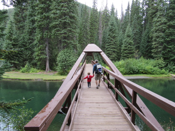
You’ll soon come to a junction where a trail heads right to the attractive Rainbow Bridge which spans a narrow strait-like section of the lake. You can cut your loop short by crossing the bridge and picking up the loop trail again on the other side of the lake. But if that’s not in your plans, be sure to at least mosey out on the bridge for some good views.
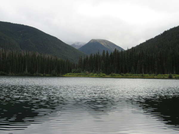
The loop continues to the placid south end of the lake. The way cuts across a few talus slopes, providing good views of the lake below. Eventually the trail swings around the southwest shore of the lake, crosses cascading Frosty Creek and then Lightning Creek before coming to a junction. The way left continues to the other three lakes in the Lightning Lakes chain—Flash, Strike and Thunder. You can head that way if you’re interested in a good all-day hike. Otherwise head right to complete the loop.
Now on the west side of the lake, enjoy occasional views east up the steep slopes of Mount Frosty. The trail passes a few spur trails that lead to the shore. It soon comes to a junction with the Skyline I Trail, one of the most scenic trails within the park. Soon after that the trail comes to another junction. Here a short trail leads left to the Spruce Bay Trailhead, an alternative start.
The loop continues, soon coming to a junction with the trail heading over the Rainbow Bridge. The way then crosses a couple of smaller bridges spanning marshy areas before coming an open grassy area and a beach popular with folks staying at the nearby campground. The trail then rounds Spruce Bay where a trail leads left to the campground. The main way hugs the lakeshore, traveling along a bluff housing busy campsites.
The trail then rounds a large cove known as Lone Duck Lake, crossing a creek coming down from Gibson Pass along the way. The cove with its calm water is a popular spot with canoeists. The way eventually rounds a point at the mouth of the cove before returning to the trailhead. If it’s a warm summer day, consider a jump in the lake before returning home or to your campsite.
All photos by Craig Romano.
Craig Romano is an award-winning author of more than twenty hiking guidebooks, including Day Hiking North Cascades (Mountaineers Books) which includes many scenic trails just south of Manning Park in the North Cascades National Park complex.
Above: the Lightning Lake trail in British Columbia’s Manning Provincial Park is a great outing for all ages.

Location: E. C. Manning Provincial Park
Distance: 5.6 miles (9.0 kilometers) roundtrip
Elevation gain: minimal
Difficulty: easy
Trail notes: Dogs permitted on leash. Practice Leave No Trace principles.
Trail highlights: Family-friendly hike in the heart of Manning Park; exceptional wildlife viewing; good hike for overcast days
Contact: E.C. Manning Provincial Park
Getting to the trail: from Vancouver follow Trans-Canada Highway 1 east to Hope. Then continue east on BC 3 (Crowsnest Highway) for 37.5 miles (60 kilometers) and turn right on the Gibson Pass Road in Manning Park near the lodge. Continue for 1.8 miles (2.9 kilometers) and bear left, driving another 0.5 mile (0.8 kilometer) to large parking area and trailhead.

